TOWNLANDS IN THE
CIVIL PARISH OF TEMPLEBREEDY
BARONY OF KERRYCURRIHY
INDEX OF TEMPLEBREEDY TOWNLANDS
Click on the NAME to jump to that TOWNLAND- - - - - - - - -
Achadh Mhártain / AGHAMARTA
Baile an Loiscthe / BALLINLUSKA
Bun an Tábhairne / CROSSHAVEN
Cnoc Muircheartaigh / CROSSHAVEN HILL
An tAiteann Francach / FRENCHFURZE
Gort na nUan / GORTNANOON
Rinn an Bhrú / HODDERSFIELD
Inse Geimhleach / INCHIGEELAGH
Cill Chúile / KILCOLTA
Cill Mhichíl Thoir / KILMICHAEL EAST
Cill Mhichíl Thiar / KILMICHAEL WEST
Cnoc na nGabhar / KNOCKNAGORE
Baile an Chuainín / MYRTLEVILLE
- - - - - - - - -
About
TOWNLANDS, Civil Parishes and Baronies
- - - - - - - - - - - - - - - - - -
An Post delivery office for Crosshaven - P43 Eircode
- - - - - - - - -
Crosshaven lies in the barony of Kerrycurrihy / Ciarraí Cuirche. The following map of the baronies in County Cork is taken from the Baronies of Ireland 1899 map, see here. The Barony of Kerrychurrihy consists of 10 civil parishes and these in turn contain townlands. There are 76 known townlands in the barony. The local civil parish is Templebreedy ♰Teampall Bríde and it contains 13 townlands (listed below). The parish covers an area of 11km2 or 1,100 hectares. - ♰ (Name details on logainm.ie - Placenames Database of Ireland)
1899 Map of the Baronies of Co. Cork
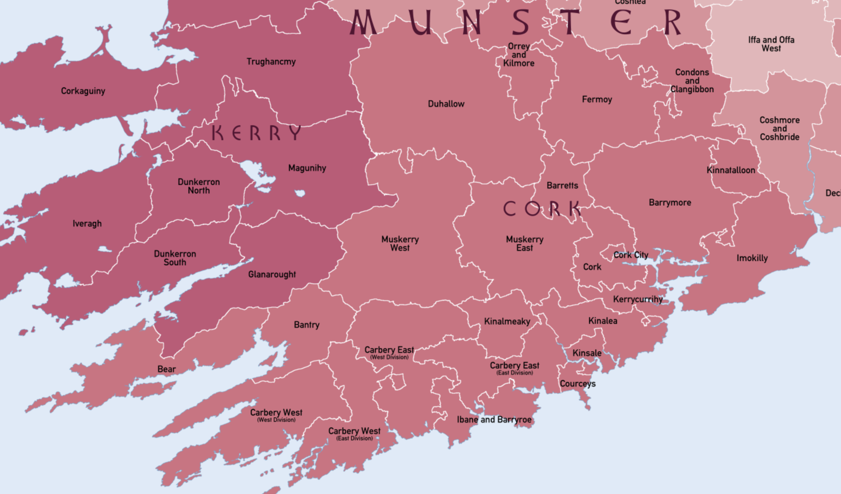
Click HERE to download this map
To view the Baronies of Ireland 1899 map, CLICK HERE
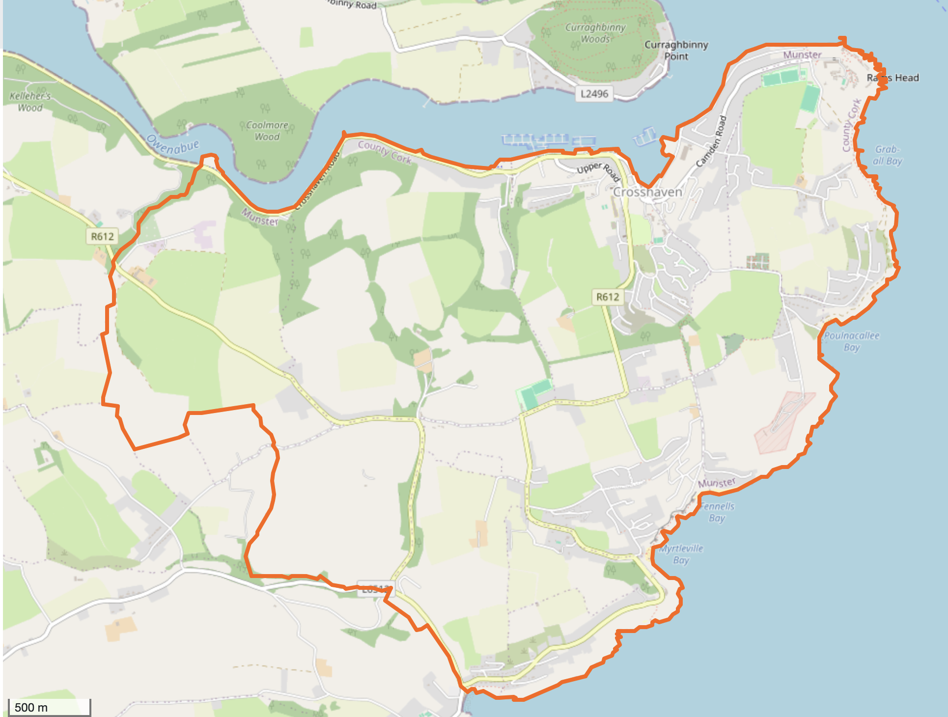
Map of Templebreedy Civil Parish on Open Street Maps
BACK TO TOP OF THIS PAGE
1
BACK TO TOP OF THIS PAGE
CLICK ON ANY OF THE FOLLOWING MAPS TO SEE THAT TOWNLAND'S AREA ON OPEN STREET MAPS
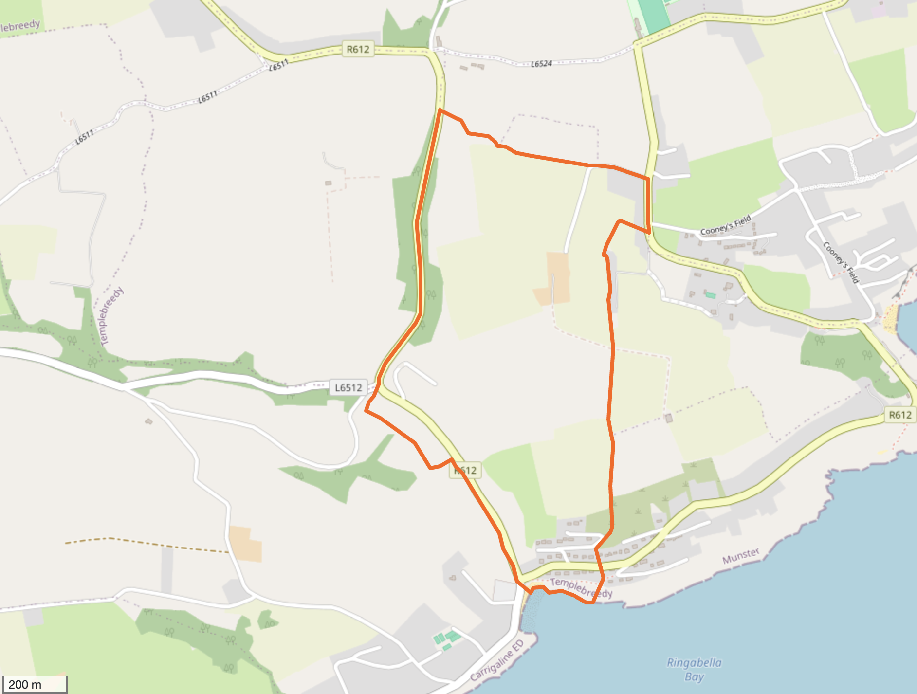
Townland of Achadh Mhártain / AGHAMARTA
The townland of Aghamarta has an area of 1,521,372 m² or 152.14 hectares.
Aghamarta borders the following other townlands:
Ballynaneening to the west
Boycestown to the west
Fountainstown North to the south
Frenchfurze to the west
Gortnanoon to the east
Hoddersfield to the east
Killeen to the south
BACK TO TOWNLAND INDEX
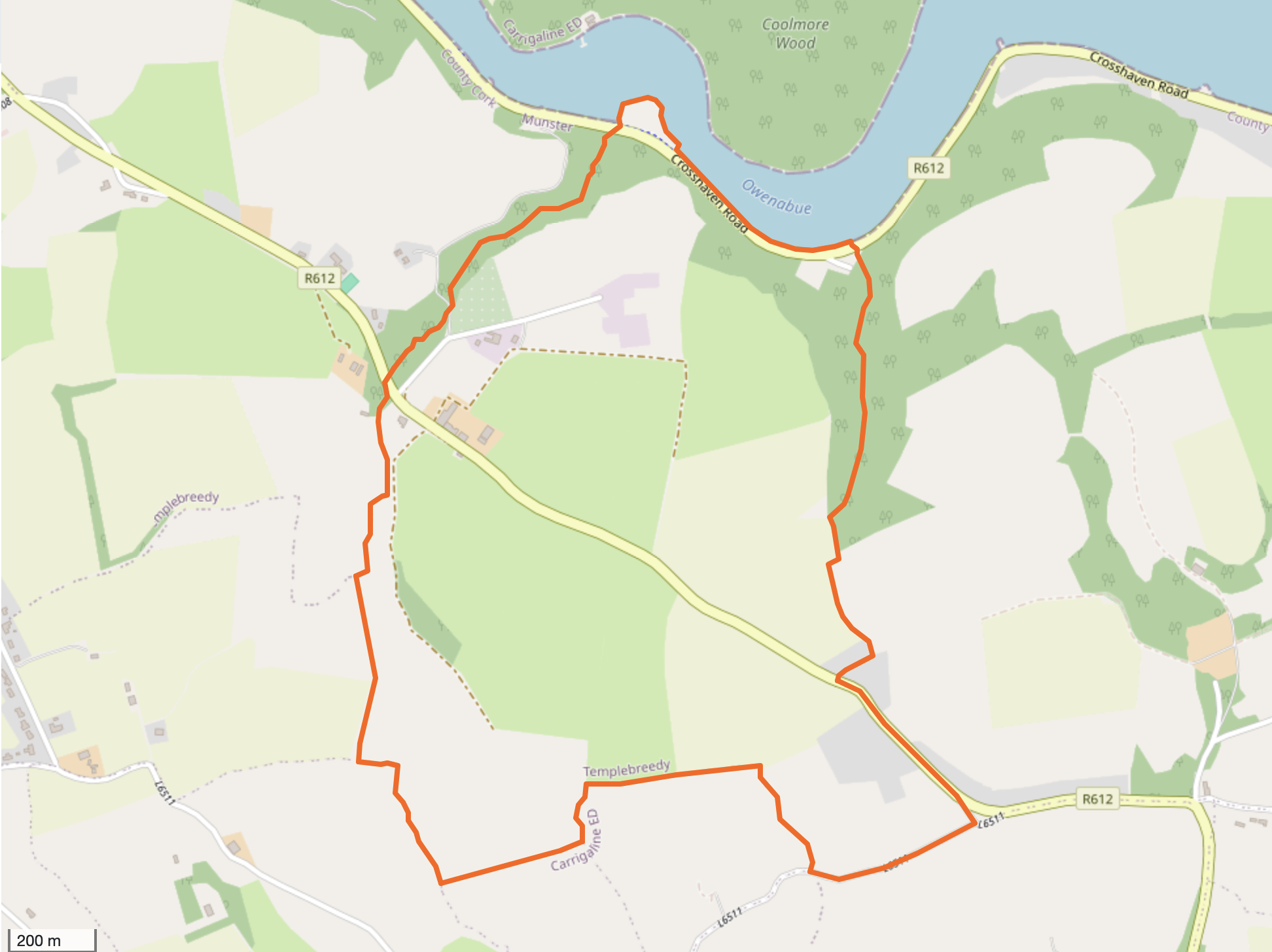
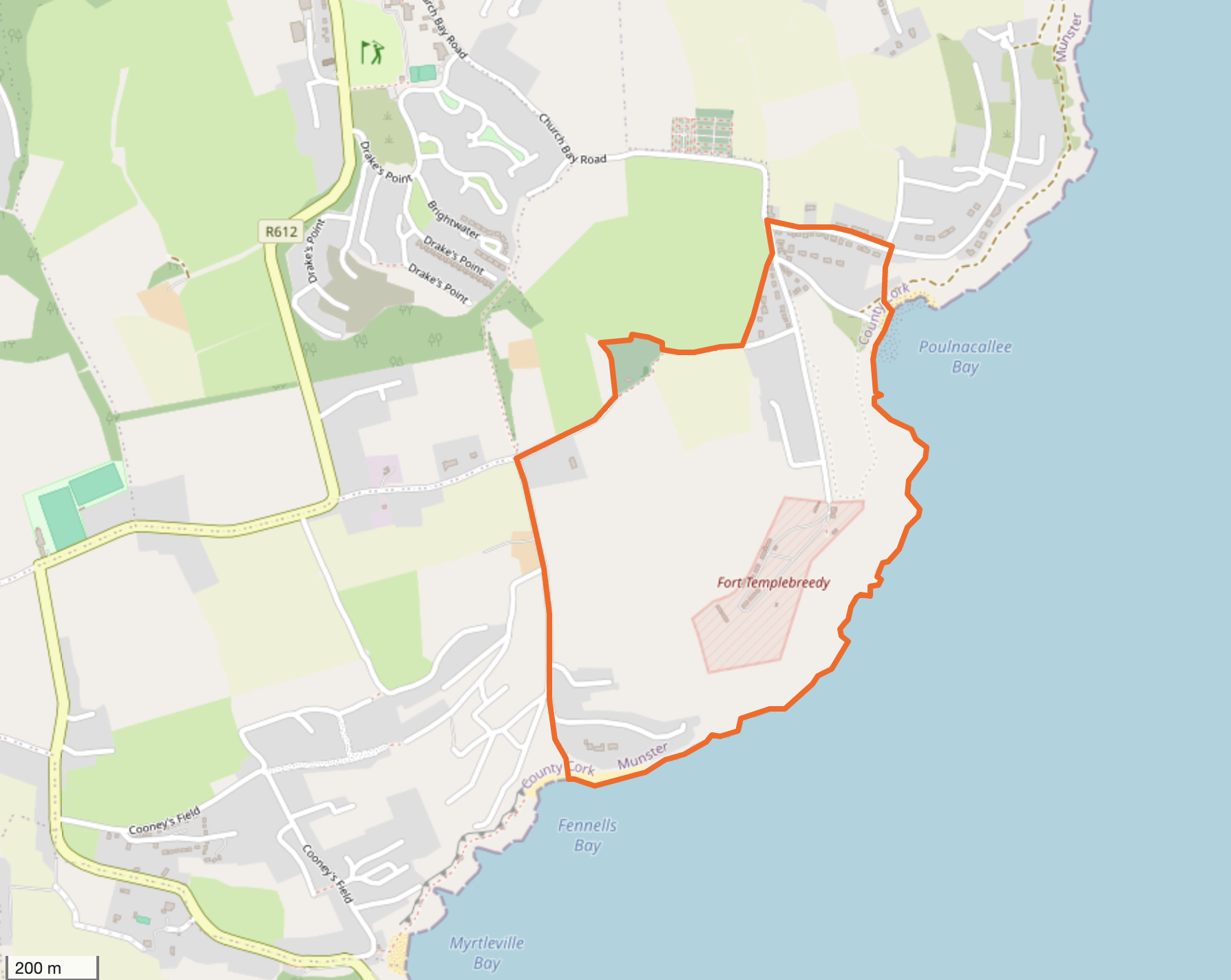
Townland of Baile an Loiscthe / BALLINLUSKA
The townland of Ballinluska has an area of 1,057,164 m² or 105.72 hectares.
Ballinluska borders the following other townlands:
Crosshaven to the east
Gortnanoon to the west
Hoddersfield to the west
Inchigeelagh to the west
Kilcolta to the east
Kilmichael West to the west
Knocknagore to the north
Myrtleville to the south
BACK TO TOWNLAND INDEX
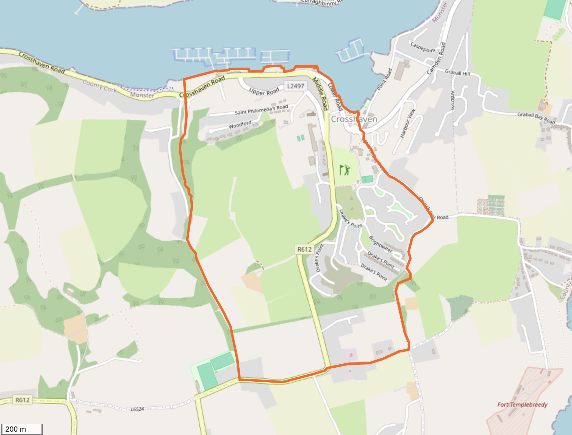
Townland of Bun an Tábhairne / CROSSHAVEN
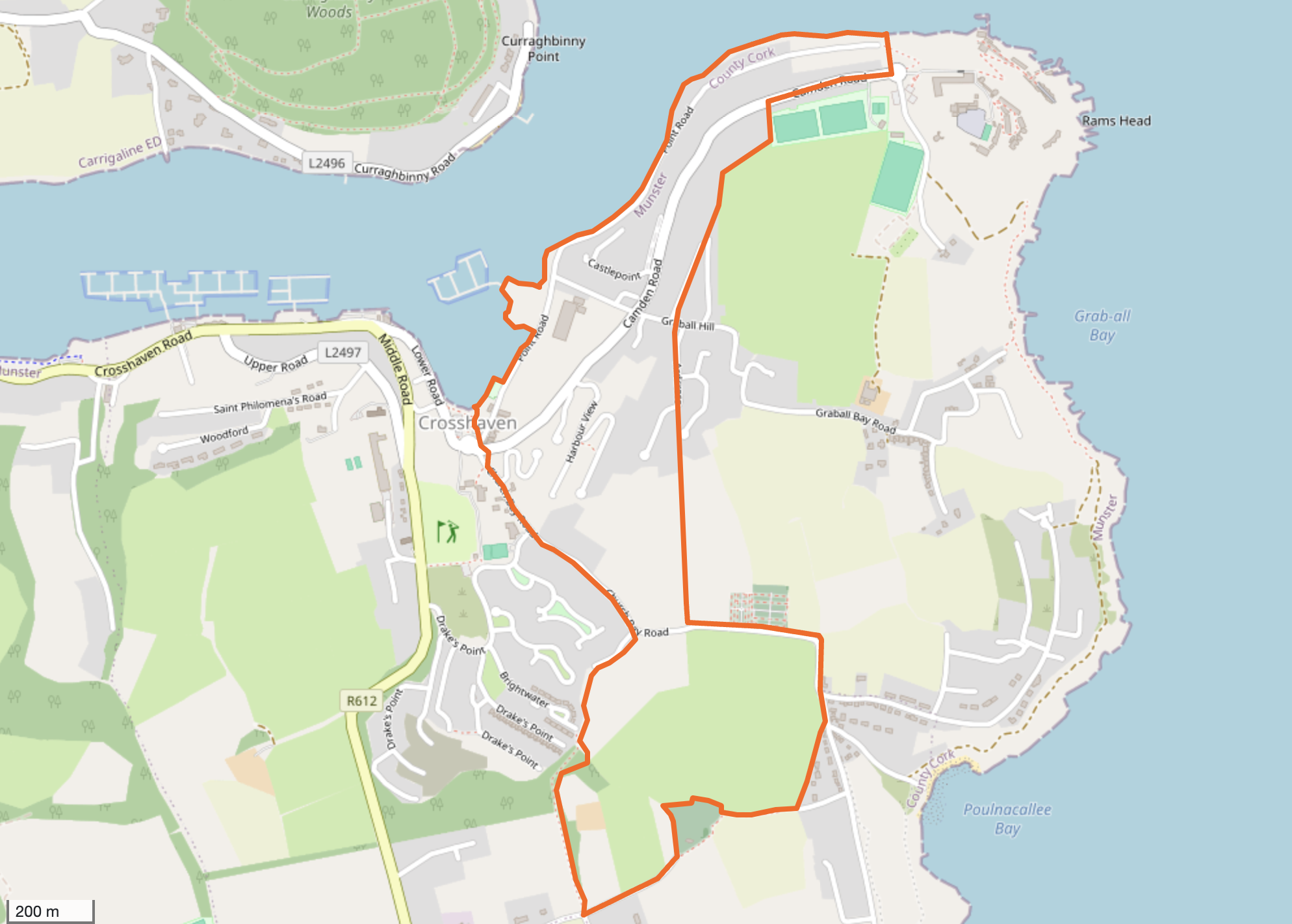
The townland of Crosshaven has an area of 686,994 m² or 68.70 hectares.
Crosshaven borders the following other townlands:
Ballinluska to the south
Crosshaven Hill to the east
Kilcolta to the south
Knocknagore to the south
BACK TO TOWNLAND INDEX
Townland of Cnoc Muircheartaigh / CROSSHAVEN HILL
The townland of Crosshaven Hill has an area of 1,234,400 m² or 123.44 hectares.
Crosshaven Hill borders the following other townlands:
Crosshaven to the west
Kilcolta to the south
BACK TO TOWNLAND INDEX
Townland of An tAiteann Francach / FRENCHFURZE
The townland of Frenchfurz has an area of 2,013,206 m² or 201.32 hectares.
Frenchfurze borders the following other townlands:
Aghamarta to the east
Boycestown to the south
Kilnaglery to the west
BACK TO TOWNLAND INDEX
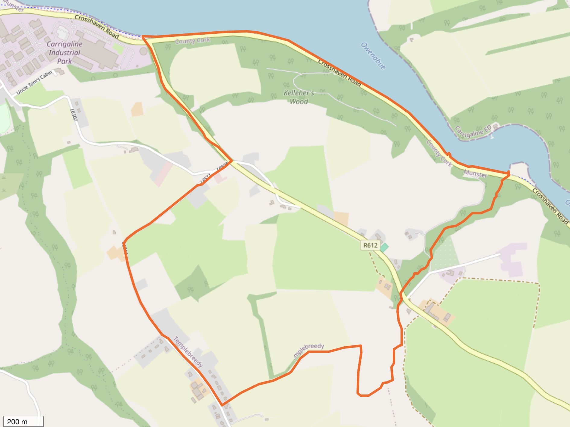
Townland of Gort na nUan / GORTNANOON
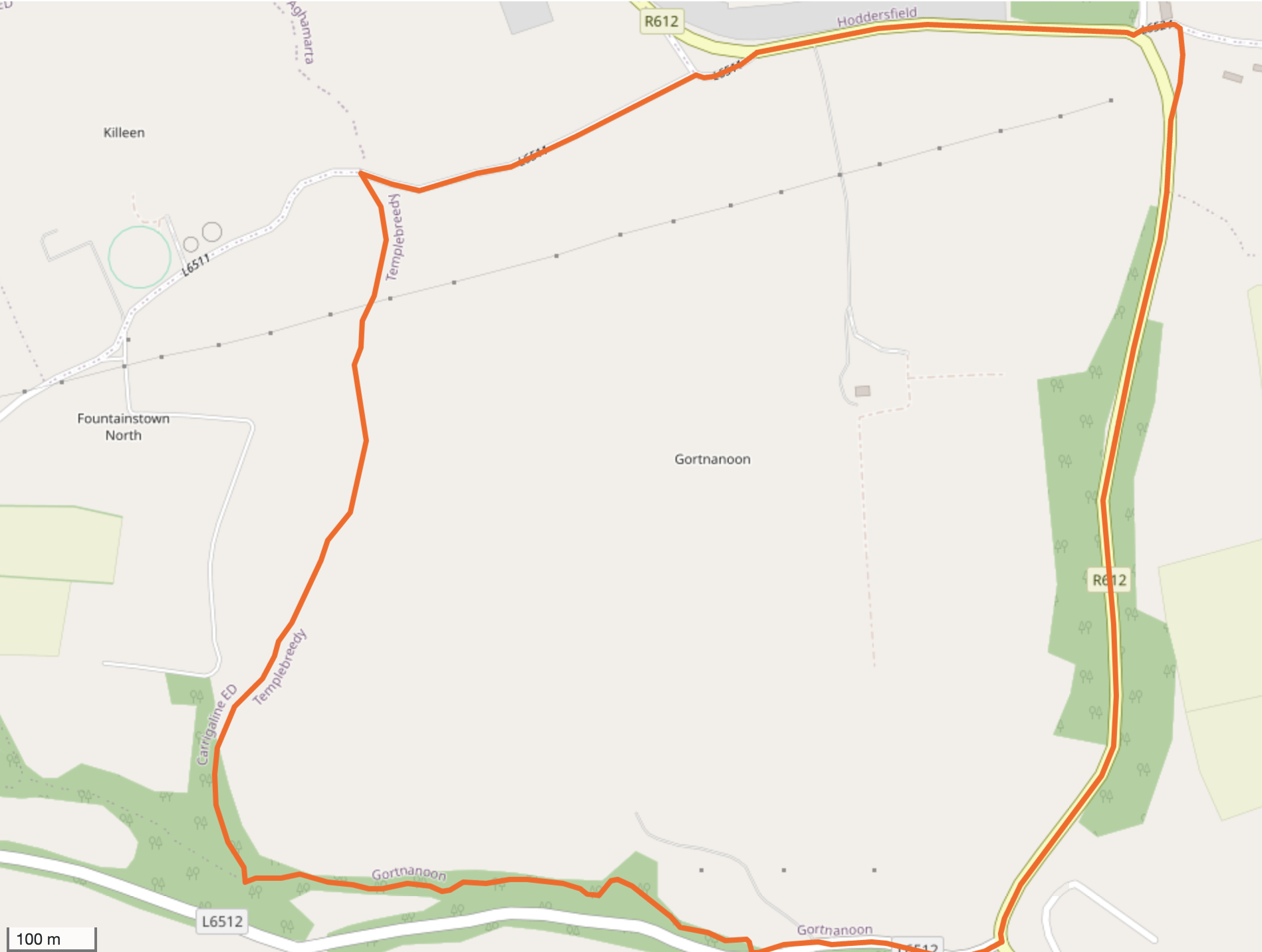
The townland of Gortnanoon has an area of 823,926 m² or 82.39 hectares.
Gortnanoon borders the following other townlands:
Aghamarta to the north
Ballinluska to the east
Fountainstown to the south
Fountainstown North to the west
Hoddersfield to the north
Killeen to the west
Kilmichael West to the east
BACK TO TOWNLAND INDEX
Townland of Rinn an Bhrú / HODDERSFIELD
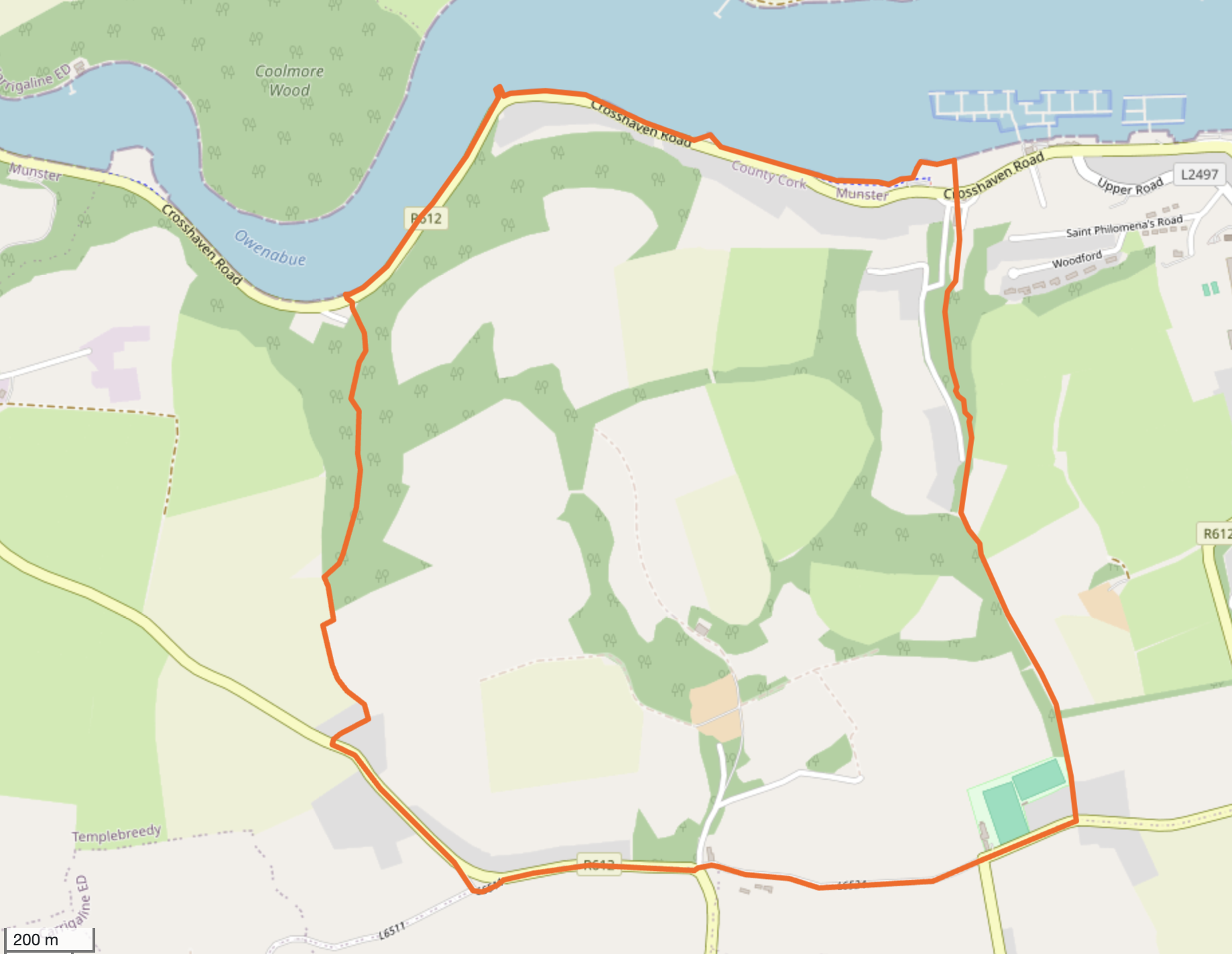
The townland of Hoddersfield has an area of 2,216,949 m² or 221.69 hectares.
Hoddersfield borders the following other townlands:
Aghamarta to the west
Ballinluska to the east
Gortnanoon to the south
Knocknagore to the east
BACK TO TOWNLAND INDEX
Townland of Inse Geimhleach / INCHIGEELAGH
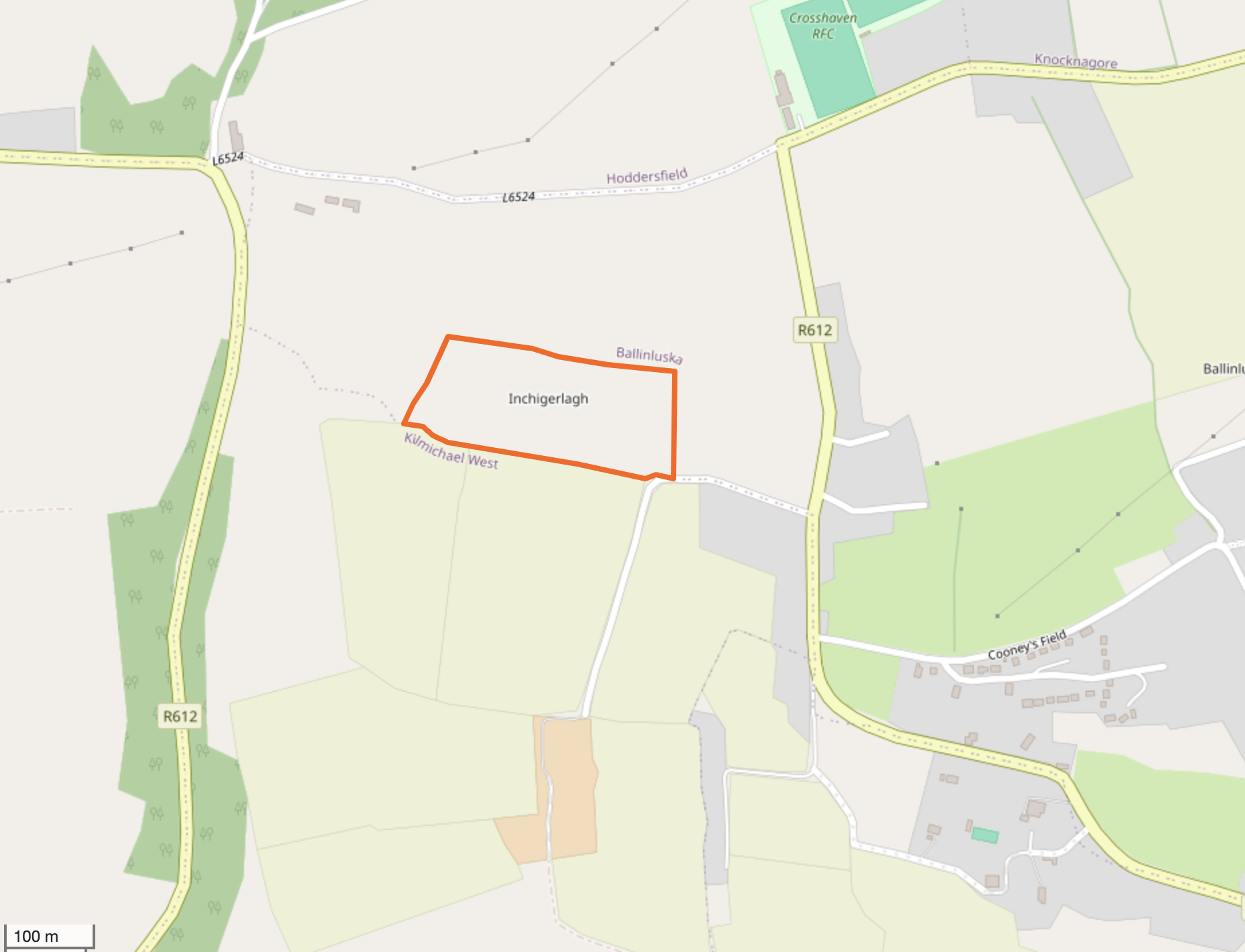
The townland of Inchigeelagh has an area of 32,105 m² or 3.21 hectares.
Inchigeelagh borders the following other townlands:
Ballinluska to the north
Kilmichael West to the south
BACK TO TOWNLAND INDEX
Townland of Cill Chúile / KILCOLTA
The townland of Kilcolta has an area of 649,399 m² or 64.94 hectares.
Kilcolta borders the following other townlands:
Ballinluska to the west
Crosshaven to the north
Crosshaven Hill to the north
Knocknagore to the west
BACK TO TOWNLAND INDEX
Townland of Cill Mhichíl Thoir / KILMICHAEL EAST
The townland of Kilmichael East has an area of 412,655 m² or 41.27 hectares.
Kilmichael East borders the following other townlands:
Kilmichael West to the west
Myrtleville to the north
BACK TO TOWNLAND INDEX
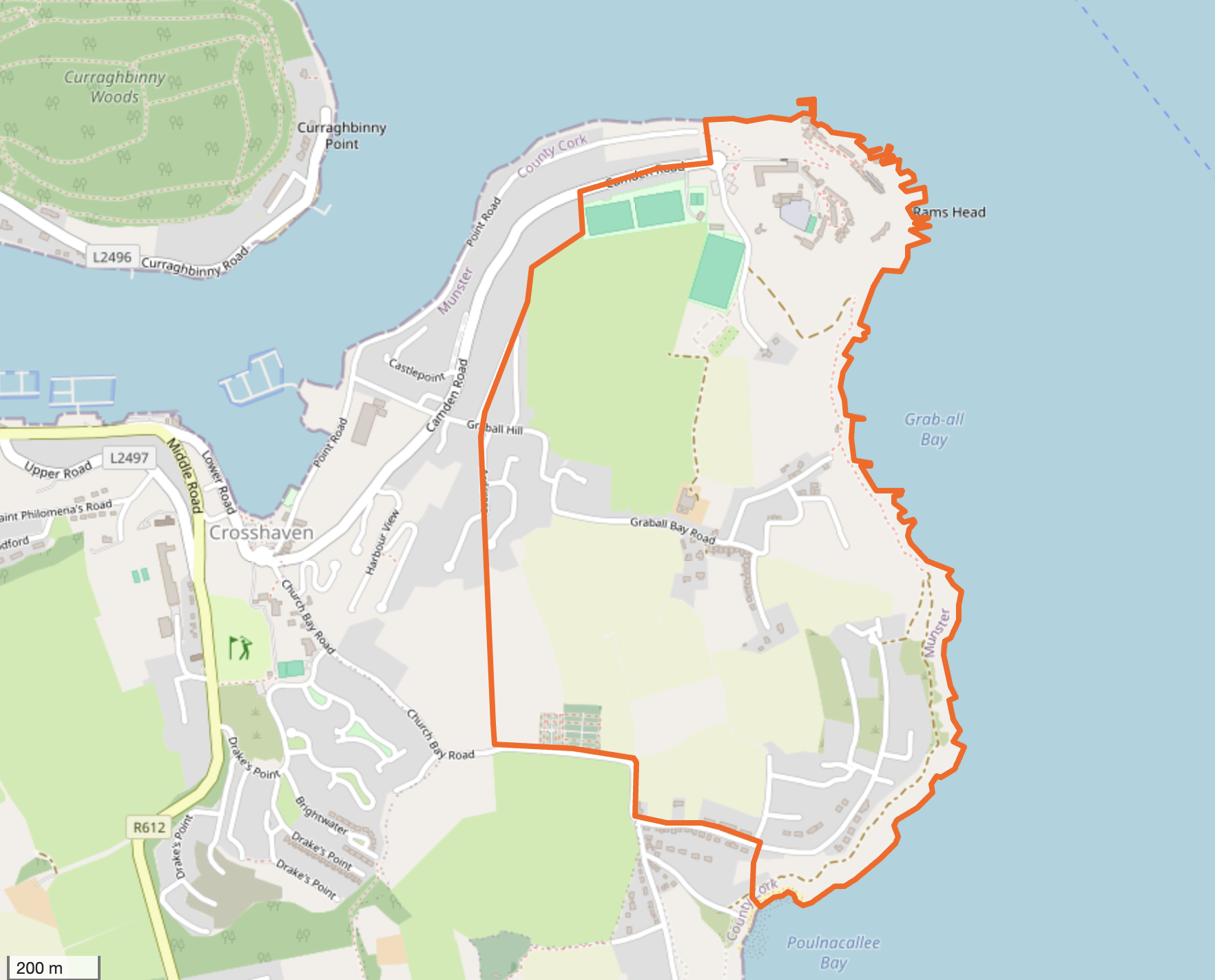
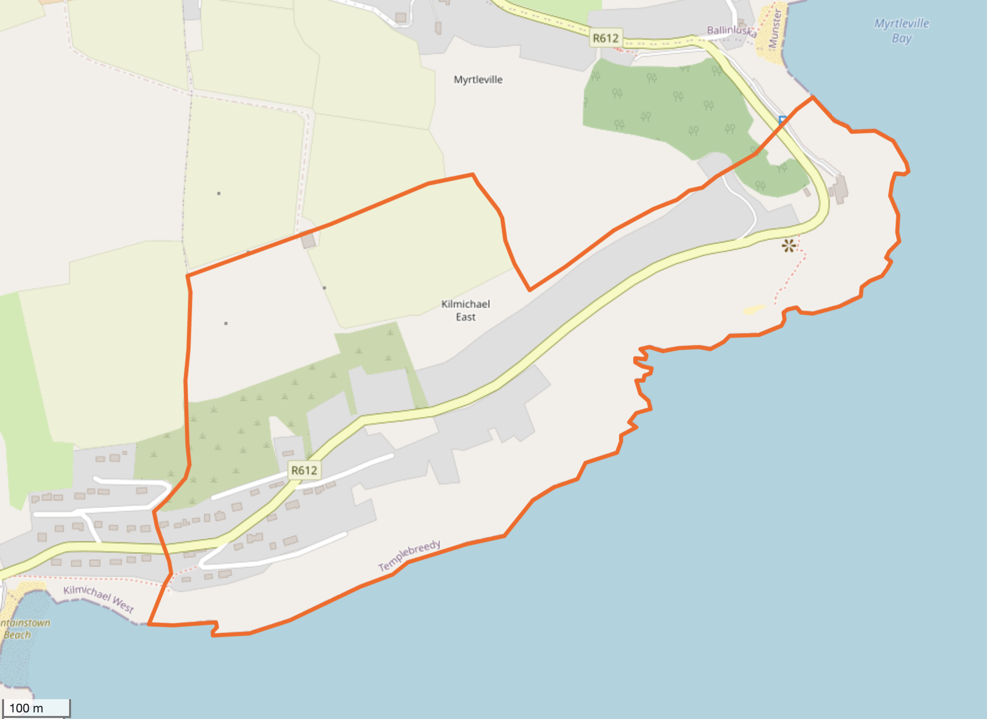
Townland of Cill Mhichíl Thiar / KILMICHAEL WEST
The townland of Kilmichael West has an area of 742,334 m² or 74.23 hectares.
Kilmichael West borders the following other townlands:
Ballinluska to the north
Fountainstown to the south
Gortnanoon to the west
Inchigeelagh to the north
Kilmichael East to the south
Myrtleville to the east
BACK TO TOWNLAND INDEX
Townland of Cnoc na nGabhar / KNOCKNAGORE
The townland of Knocknagore has an area of 1,347,063 m² or 134.71 hectares.
Knocknagore borders the following other townlands:
Ballinluska to the south
Crosshaven to the east
Hoddersfield to the west
Kilcolta to the east
BACK TO TOWNLAND INDEX
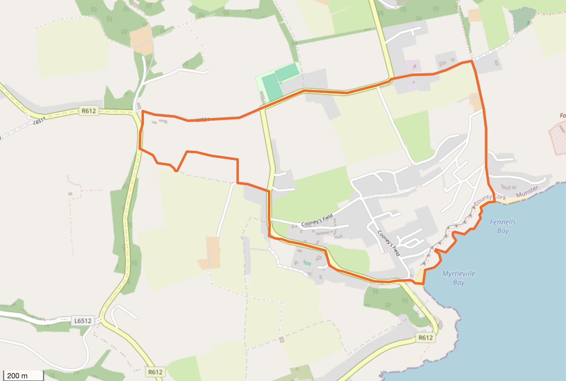
Townland of Baile an Chuainín / MYRTLEVILLE
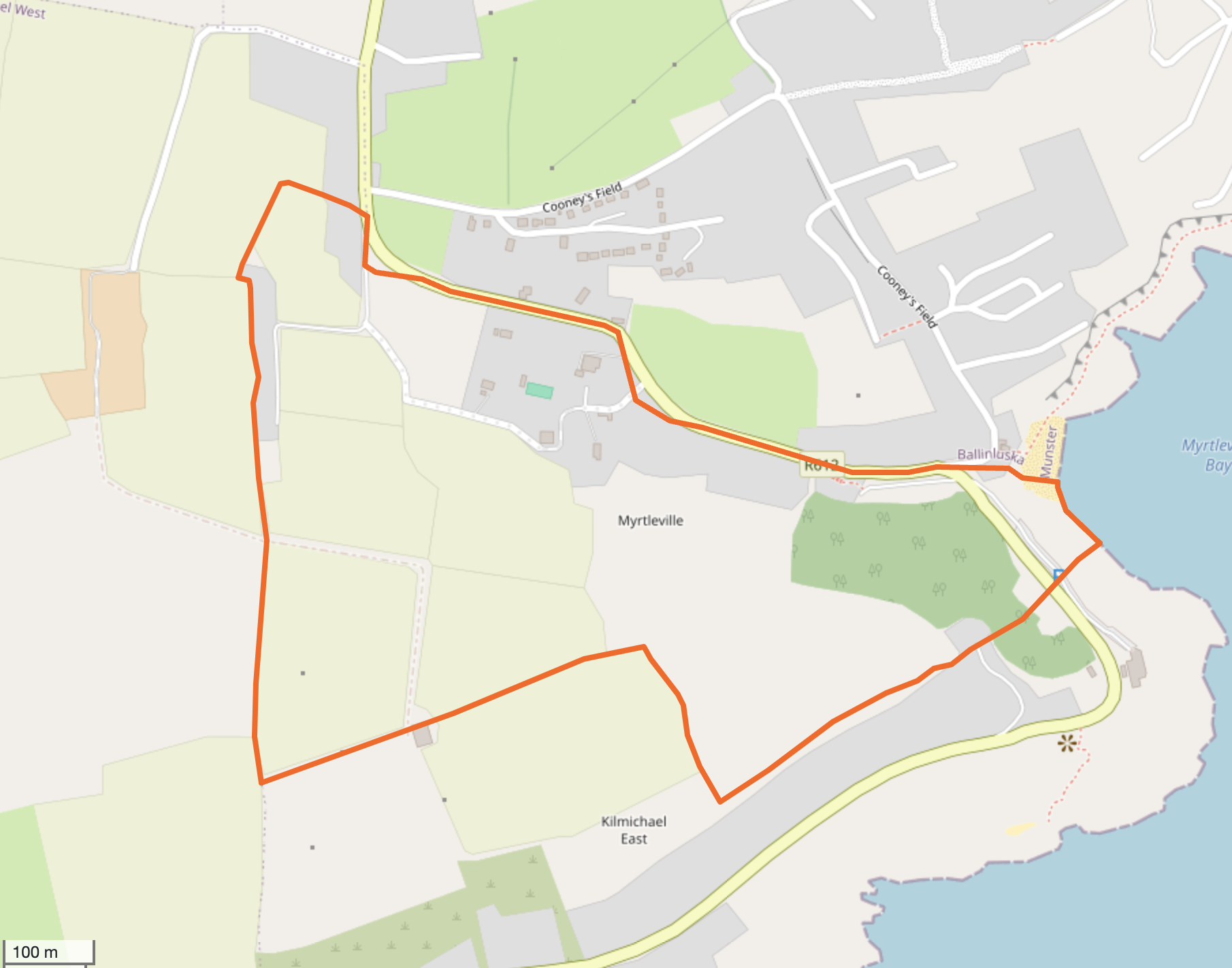
The townland of Myrtleville has an area of 320,058 m² or 32.01 hectares.
Myrtleville borders the following other townlands:
Ballinluska to the east
Kilmichael East to the east
Kilmichael West to the west
Killeen to the south
BACK TO TOWNLAND INDEX
TOWNLANDS / Talamh an Bhaile
Baronies & Civil Parishes
Baronies
Baronies were larger administrative subdivisions of counties, established mostly in the 15th and 16th centuries by the British administration. There are 273 baronies in Ireland, each comprising multiple civil parishes. Baronies no longer have any administrative function today, but are still referenced in some historical records.
- - - - -
Civil Parishes
Civil parishes were the smallest administrative units in Ireland, based on medieval Christian parish boundaries. There are around 2,400 civil parishes in Ireland, which were used for local government and ecclesiastical purposes. Civil parish boundaries often corresponded to Church of Ireland parish boundaries, but not always to Roman Catholic parish boundaries. Civil parishes were later replaced by Poor Law Unions by the British as the basic administrative division in Ireland during the 19th century.
- - - - -
TOWNLANDS
A townland or talamh an bhaile (baile fearainn) is a small geographical division of land, historically and currently used in Ireland. The townland system is of Gaelic origin, predates the Norman invasion and the occupation of Ireland by the British. Most townlands have names of Irish origin. However, some townland names and boundaries come from Norman manors, plantation divisions, or later creations of the Ordnance Survey.
In Ireland, a townland is generally the smallest administrative division of land, typically covering 40 to 200 hectares, though a few large townlands are further divided into hundreds. Townlands form the building blocks for higher-level administrative units such as parishes and district electoral divisions in Ireland or wards in Northern Ireland. Before 1972, townland names were included on all rural postal addresses throughout the island, but the British Royal Mail decided they were obsolete in Northern Ireland that year.
The concept of townlands is based on the Gaelic system of land division, and the first official evidence of the existence of this Gaelic land division system can be found in church records from before the 12th century. It was in the 1600s that townlands began to be mapped and defined by the English occupation administration for the purpose of confiscating land / ethnic cleansing and apportioning it to planters from Britain.
The total number of inhabited townlands in Ireland was 60,679 in 1911. The total number recognised by the Irish Place Names Database as of 2014 is 61,098, including uninhabited townlands, mainly small islands. There is one uninhabited townland in the Crosshaven area, the townland of Inse Geimhleach / INCHIGEELAGH.
In summary, townlands are the most granular and historically significant land divisions in Ireland, while baronies and civil parishes represent larger administrative units that were used for different governmental and ecclesiastical purposes during the British occupation of Ireland. Knowing the townland, civil parish, and barony associated with an ancestor is crucial for Irish genealogical research.
- - - - -
Back to the TOP - TOWNLANDS INDEX
- - - - -
Of course now we have Eircodes, a unique one for every property in the state. WEBSITE HERE
So no longer a need for a townland, or a street address or a village/town name or even a county.
JUST THE EIRCODE!.
BACK TO TOWNLAND INDEX
- - - - -
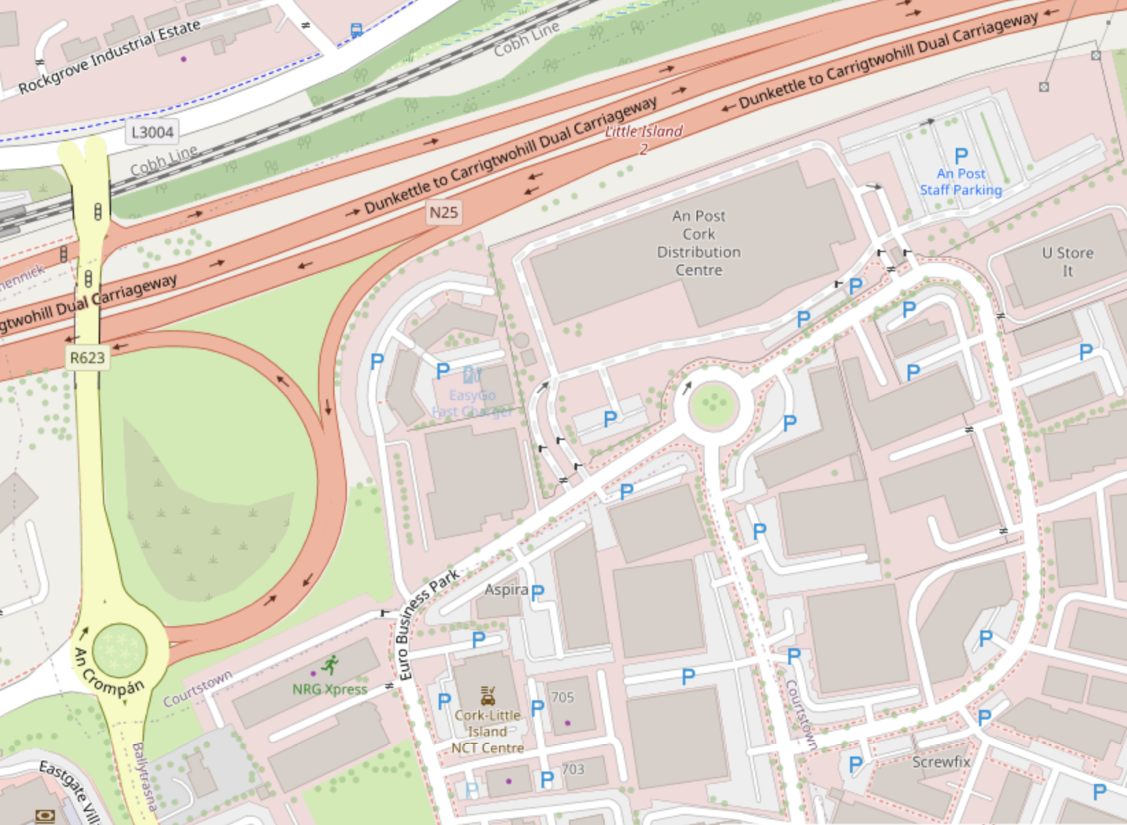
Our world is becoming bland and very booring! - Now we are served by P43, some person or machine in Port Laoise.
An Post now appear to have no knowledge of where Bun an Tábhairne is.
Consequently our post is frequently being delayed for weeks or even not being delivered at all!
This is where An post delivery office for Crosshaven is located, no longer a local facility in Carrigaline but in Little Island - See HERE!
It's 26Km from Crosshaven with no direct public transport to get there. It's around the corner from the Little Island NCT Centre.
BACK TO TOP OF THIS PAGE
Published March2025 / Foilsithe Márta 2025
All images on this page - Don Slyne
------
Copyright
©2002-2026 crosshaven.net
All Rights Reserved
Copyright
©2002-2026 crosshaven.net
All Rights Reserved